Tableland:
An area of elevated land with a nearly level surface.
Tar Sand:
A sandstone that contains asphalt within its pore spaces.
Talus:
An accumulation of angular rock debris at the base of a cliff or steep slope that was produced by physical weathering.
Tectonics:
The study of processes that move and deform Earth's crust.
Terminal Moraine:
A mound of unsorted glacial till that marks the furthest advance of a glacier.
Terrestrial Planet:
One of the four rocky planets closest to the sun, which include Mars, Venus, Earth and Mercury.
Terrigenous Sediment:
Sediment that is derived from the weathering of rocks which are exposed above sea level.
Texture:
The visible characteristics of a rock which include its grain size, grain orientation, rounding, angularity or presence of vesicles.
Thermal Pollution:
Water quality is not defined by chemistry alone. If natural waters are withdrawn for use they should be returned to the environment at approximately the same temperature. An increase or decrease in temperature can have an adverse effect upon plants, animals and chemical balances. Returning water to a stream at a different temperature than it was withdrawn is known as thermal pollution. For example, coal-fired power plants use water in the production of steam that turns turbines. That water is then cooled in the large cooling towers before it is returned to the environment.
Thrust Fault:
A reverse fault that has a dip of less than 45 degrees.
Tidal Current:
Currents of water that are produced in response to a rising or falling tide. These currents can flow into or out of a bay, delivering the rising water or removing the falling water.
Tidal Flat:
A broad flat area, very close to sea level that is flooded and drained with each rise and fall of the tide.
Tidal Wave:
A term that is incorrectly used in reference to a tsunami. Tsunamis have nothing to do with the tides.
Till:
An unsorted sediment deposited directly by a glacier and not reworked by meltwater.
Topographic Map:
A map that shows the change in elevation over a geographic area through the use of contour lines. The contour lines trace points of equal elevation across the map.
Topography:
The shape of Earth's surface or the geometry of landforms in a geographic area.
Trace Element:
An element that is present in very small quantities.
Trachyte:
A fine-grained volcanic rock that contains large amounts of potassium feldspar.
Traction:
Transport of sediment by wind or water in which the sediment remains in contact with the ground or bed of the stream, moving by rolling or sliding.
Transform Fault:
A strike-slip fault that connects offsets in a mid-ocean ridge.
Transgression:
An advance of the sea over land areas. Possible causes include a rise in sea level or subsidence.
Transmission Pipeline:
A pipeline that carries natural gas from a region where it is produced to a region where it is stored or consumed.
Transpiration:
A process of plants removing water from the soil and releasing it into the atmosphere through their leaves.
Transverse Dunes:
Sand dunes that are oriented at right angles to the direction of the prevailing wind. These form where vegetation is sparse and the sand supply is abundant.
Trap:
A sedimentary or tectonic structure where oil and/or natural gas has accumulated. These are structural highs where a porous rock unit is capped by an impermeable rock unit. Oil and gas trapped within the porous rock unit migrate to a high point in the structure because of their low density.
Travertine:
Calcium carbonate deposits which form in caves and around hot springs where carbonate-bearing waters are exposed to the air. The water evaporates, leaving a small deposit of calcium carbonate.
Trellis Drainage:
A drainage pattern in which streams intersect at right angles. This forms in areas of long parallel valleys such as in folded mountain belts. Rivers occupy the valleys and tributary streams join them at right angles.
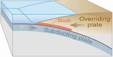
Trench:
A long, narrow, deep depression in the ocean floor that parallels a convergent boundary involving at least one oceanic plate.
Triple Junction:
A point where three lithospheric plates meet. Triple junctions can be areas of unusual tectonic activity due to the differential motions of the three intersecting plates.
Tsunami:
A large sea wave normally produced by sudden movement of the ocean floor caused by an earthquake or volcanic eruption. These waves can travel at high speeds across an ocean basin and cause great destruction when they reach land.
Tuff:
A rock composed of pyroclastic materials that have been ejected from a volcano. In many instances these fragments are still hot when they land, producing a "welded" rock mass. Picture of Tuff.
Turbidite:
A vertical sequence of sediments deposited by a turbidity current. Because the largest particles of the current settle first a turbidite will be graded deposits with coarsest grain sizes at the bottom and finer grain sizes going upwards.
Turbidity Current:
A mixture of sediment particles and water that flows down the continental slope. These high density currents can reach great speeds and generally erode loose sediments from the seafloor beneath them. See also: Density Current.
Turbulent Flow:
An irregular state of fluid flow in which the particle paths cross one another and may even travel in opposing directions. (Compare with Laminar Flow.)


